Log in
All resources
Create a design
4,886 Free Images of Map Lichen
bibliothèque nationale de france
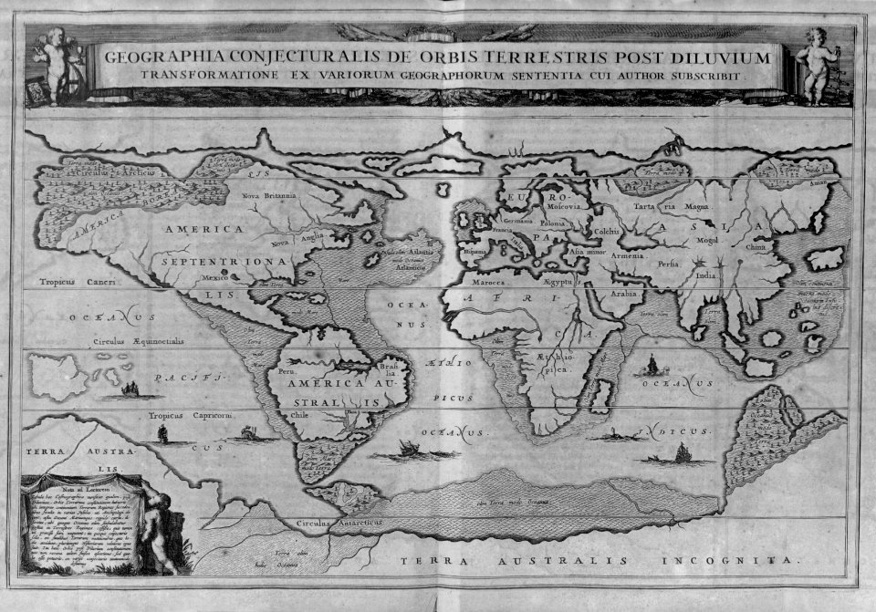
a map of the british empire in america with the french and spanish settlements adjacent thereto
smithsonian libraries
textile and oil painting on canvas
map - museu antônio parreiras
antônio parreiras
רקעים כחולים - ועוד רקעים
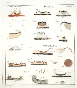
lichenographia universalis. in qua lichenes omnes detectos, adiectis observationibus et figuris horum vegetabilium naturam et organorum carpomorphorum structuram illustrantibus, ad genera, species, varietates differentiis et observationibus sollicite defi
engraving
pages with maps
backs of postcards in curt teich postcard archives
postcards of st. louis, missouri
lawrence h. slaughter collection of english maps, charts, globes, books and atlases
nypl lionel pincus and princess firyal map division
backs of postcards in curt teich postcard archives
postcards of madison county, illinois
backs of postcards in curt teich postcard archives
postcards of creek county, oklahoma
john rocque's 1746 map of london
details of old maps of london
backs of postcards in curt teich postcard archives
postcards of ottawa county, oklahoma
old submaps of paris 5e arrondissement
porte saint-victor (paris)
maps by willem and johannes blaeu
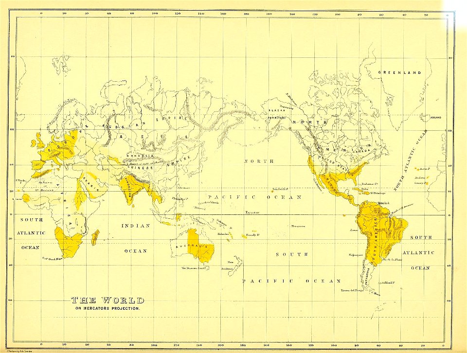
old maps with mercator projection
19th-century maps of bohemia
maps of regions of bohemia
curt teich postcard archives, curt teich & company
map postcards
bird
owl
map of ancient armenia by philippe de la rué
maps of antony's parthian war
cartography
maps
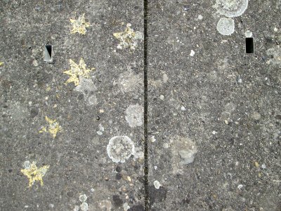
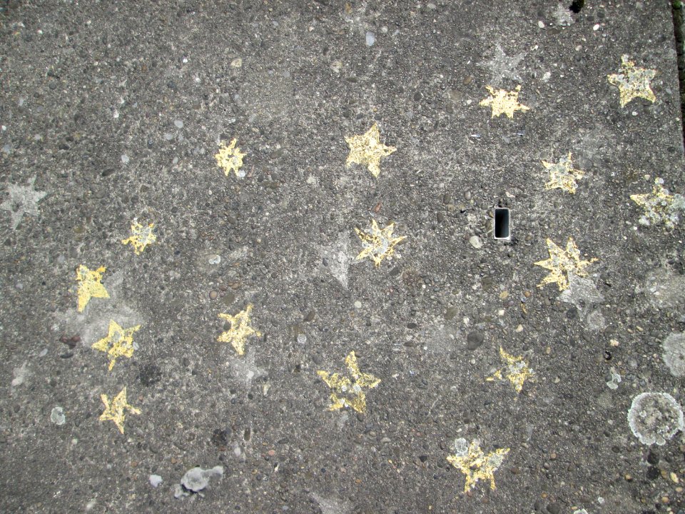
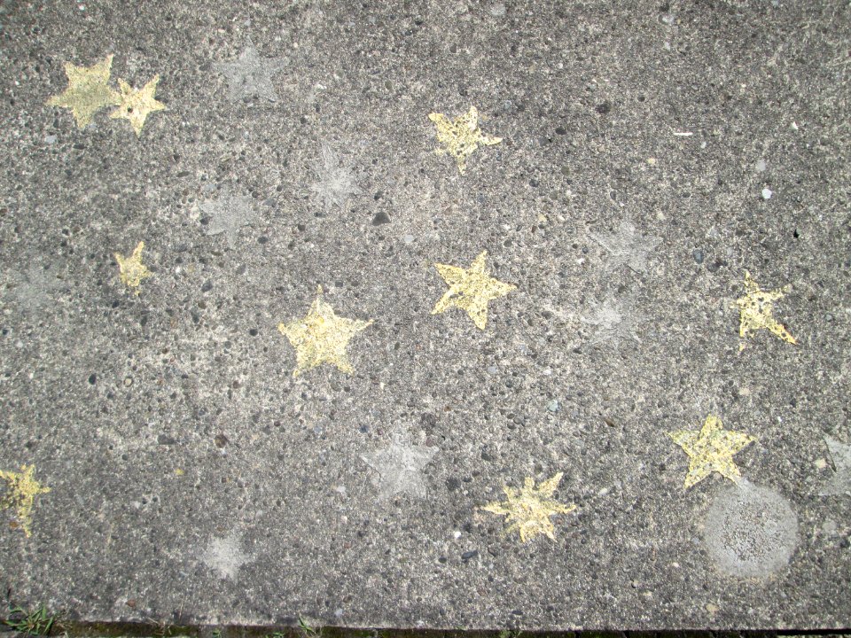
sidewalk
pavement
pavement
yellow
everett d. graff collection of western americana
maps by g. w. & c. b. colton & co.
arnold van langren map of southwest africa
renaissance
science
geology
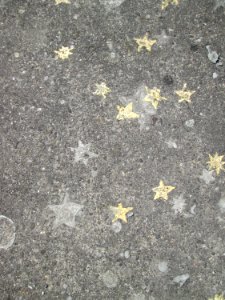
pavement
yellow
maps
city
fourrure et pelletiers. a travers les ages
furriers in paris
map of the upper rhenian circle by sanson
maps by nicolas sanson
map of the upper rhenian circle by sanson
maps by nicolas sanson
maps of ancient israel by philippe de la rué
eran laor cartographic collection
works after map of amsterdam, 1544
maps in the rijksmuseum amsterdam
henricus hondius ii, nova totius terrarum orbis geographica ac hydrographica tabula, 1630
eran laor cartographic collection
map of paris by claes jansz. visscher - derivate files
17th-century people of paris
atlas des anciens plans de paris by imprimerie nationale, 1880 from bhvp
map of paris by jouvin de rochefort (boutier 112)
media contributed by university of illinois urbana-champaign university library
1702 maps of africa
map of paris by claes jansz. visscher - derivate files
17th-century people of paris
atlas des anciens plans de paris by imprimerie nationale, 1880 from bhvp
18th-century maps of paris
atlas des anciens plans de paris by imprimerie nationale, 1880 from bhvp
plan de turgot
1779 maps of new york (state)
old maps of new york (state)
map of ancient armenia by philippe de la rué
1650s maps of armenia
atlas des anciens plans de paris by imprimerie nationale, 1880 from bhvp
map of paris by jouvin de rochefort (boutier 112)
cartography
maps
ethnographic maps of austria-hungary
1890s maps of austria-hungary
maps of amsterdam in the rijksmuseum amsterdam
map of amsterdam, 1544
a map of the british empire in america with the french and spanish settlements adjacent thereto
1730s maps of the caribbean
a map of the british empire in america with the french and spanish settlements adjacent thereto
1730s maps of the caribbean
a map of the british empire in america with the french and spanish settlements adjacent thereto
1730s maps of the caribbean
a map of the british empire in america with the french and spanish settlements adjacent thereto
1730s maps of central america
portraits of sigismund iii of poland in engravings
details of sigismund's map of moscow
zur geschichte der kartographie nordalbaniens (map reconstructions)
coding da vinci: süd 2019
map collection of leibniz-institut für ost- und südosteuropaforschung
1733 maps of europe
postcards of churches in chicago
map postcards
map of maastricht by willem and johannes blaeu (1649)
history of wyck (maastricht)
maps from traité de la police, bibliothèque nationale de france
first map of paris from traité de la police
historical images of the place dauphine (paris)
place dauphine on maps
map of paris by braun & hogenberg - derivative files
rue des archives (paris)
juliana of the netherlands in 1969
dutch baroque architecture
paintings by antônio parreiras in the museu antônio parreiras
landscape paintings by antônio parreiras
architecture
outside
self-published work
pages with maps
sidewalk
yellow
history of whitby, north yorkshire
british library maps collections
paintings by antônio parreiras in the museu antônio parreiras
paul et virginie
curt teich postcard archives
postcards of muncie, indiana
maps from traité de la police, bibliothèque nationale de france
fourth map of paris from traité de la police
paintings by antônio parreiras in the museu antônio parreiras
paintings of cityscapes by antônio parreiras
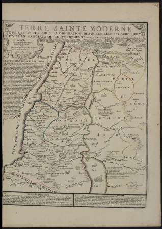
1720s maps of palestine
nicolas de fer
german-language maps from ios map collection
1910s maps of the balkans
lawrence h. slaughter collection of english maps, charts, globes, books and atlases
nypl lionel pincus and princess firyal map division
english-language maps from ios map collection
classicism
brazilian paintings in the museu antônio parreiras
antônio rafael pinto bandeira
atlas des anciens plans de paris by imprimerie nationale, 1880 from bhvp
map of paris by jouvin de rochefort (boutier 112)
atlas maior, vol 3 (germany) - joan blaeu, 1667 - bl 114.h(star).3
old maps of moravia
a map of the british empire in america with the french and spanish settlements adjacent thereto
1730s maps of the caribbean
van langren map of southeast asia
1619 maps of asia
turgot map of paris, kyoto university library – derivative files
collège du plessis
turgot map of paris, kyoto university library – derivative files
porte saint-antoine
map of the circle of the rhineland by sanson
maps by nicolas sanson
maps of the war of the spanish succession
apalachee
paintings by antônio parreiras in the museu antônio parreiras
paintings of nude females by antônio parreiras
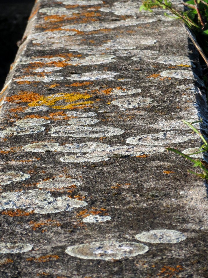
science
geology
smithsonian libraries
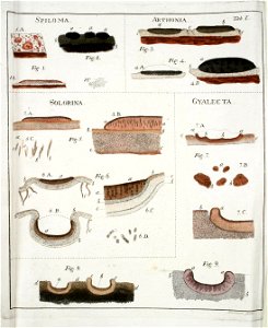
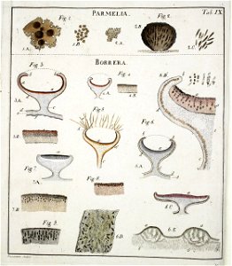
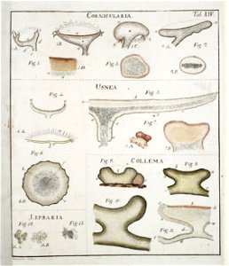
lichen
smithsonian libraries
lichen
smithsonian libraries
lichen
smithsonian libraries
lichen
smithsonian libraries
lichen
smithsonian libraries
lichen
smithsonian libraries
lichen
science
italy
cartography
maps
travel
maps
historical images of église saint-nicolas-du-chardonnet
map of paris by braun & hogenberg - derivative files
media contributed by university of illinois urbana-champaign university library
1623 maps of africa
old maps of north america from the norman b. leventhal map center
1740 maps of north america
18th-century maps of havana
1730s maps of cuba
a map of the british empire in america with the french and spanish settlements adjacent thereto
maps in the library of congress
a map of the british empire in america with the french and spanish settlements adjacent thereto
maps in the library of congress
sixth map of paris from traité de la police
maps of paris from paris musées
maps by edward wright
molyneux globes
maps from traité de la police, bibliothèque nationale de france
third map of paris from traité de la police
sanborn fire insurance map from flushing, queens county, new york
maps in the library of congress
a map of the british empire in america with the french and spanish settlements adjacent thereto
1730s maps of the caribbean
paintings by antônio parreiras in the museu antônio parreiras
paintings of nude females by antônio parreiras
historical images of the jardin du luxembourg
historical images of luxembourg palace
paintings by antônio parreiras in the museu antônio parreiras
portrait paintings by antônio parreiras
a map of the provinces of new york and new jersey, with a part of pennsylvania and the province of quebec
maps in the library of congress
3001 - 3100 of 4,886
Next page
/ 49


![Lutetia or first plan of the city of Paris taken from Cesar, Strabo, the Emperor Julian and Ammiam Marcellin [Digitized still image] / By MLCDLM, Antoine Coquart](https://cdn.creazilla.com/illustrations/10001210581/lutetia-or-first-plan-of-the-city-of-paris-taken-from-cesar-strabo-the-emperor-julian-and-ammiam-marcellin-digitized-still-image-by-mlcdlm-antoine-coquart-md.png)


![Sixth plan of the city / of Paris / And its increases, from the beginning of the Reign of Charles / VII, the year 1422, until the end of the Reign of Henry III, the year 1589 [1705], Antoine Coquart](https://cdn.creazilla.com/illustrations/10000442243/sixth-plan-of-the-city-of-paris-and-its-increases-from-the-beginning-of-the-reign-of-charles-vii-the-year-1422-until-the-end-of-the-reign-of-henry-iii-the-year-1589-1705-antoine-coquart-md.jpg)

![Third plan of the city of Paris, its extent and the towns which surrounded it under the reign of Louis the Young VII of the name [Digitized still image] / By MLCDLM, Antoine Coquart](https://cdn.creazilla.com/illustrations/10000255194/third-plan-of-the-city-of-paris-its-extent-and-the-towns-which-surrounded-it-under-the-reign-of-louis-the-young-vii-of-the-name-digitized-still-image-by-mlcdlm-antoine-coquart-sm.webp)


